Converting Decimal Degrees to Degrees Minutes Seconds

Often we are supplied with coordinates in decimal degrees but need to use Degrees, Minutes, and Seconds instead. Luckily, there are several solutions that you can use, here is a simple coordinate converter tool that I use.

Advocate Harbour Color Shaded Relief Map

A new large 8 foot color shaded relief map that I have created has been posted for display at a local tourist kiosk in Advocate Harbour, Nova Scotia. Now both tourists and residents of the area will be able to gain a better appreciation of the topography that borders the Northern Bay of Fundy region

UTM Rows and Zones

These UTM key maps can easily help you find out what UTM zone you are working from. Simply click on the map to enlarge it to expose all of the map, then find out where you are located and look for the zone and row that matches your area.

Converting between UTM, MTM and LAT/LONG

Canadian using a UTM map

Geographic coordinate systems enable us to spatially locate features on the Earth using specified set of two dimensional numbers. The coordinates of each feature represent the horizontal position (and sometimes vertical position when elevation is available) of it and one of the most commonly used coordinates is Geographic with values of latitude, longitude. However many different coordinate systems can be used to map the same area depending on various factors such as map extent, scale, end user etc. Therefore we often find in Geomatics that we can have data from different coordinate systems that we need to use together spatially in one reference system.

I am sure that most of us have run into times when we have features that have defined coordinates of one system that we need to use with a different one. (E.g. your map is in UTM (Universal Transverse Mercator) but you have been given GPS points in Lat/Long).

If you ever find yourself in need of quickly getting values converted from Geographic to UTM / MTM (Modified Traverse Mercator) or UTM / MTM to Geographic then here is a free online geographic coordinate convertor tool that I often use provided by Canadian Spatial Reference System

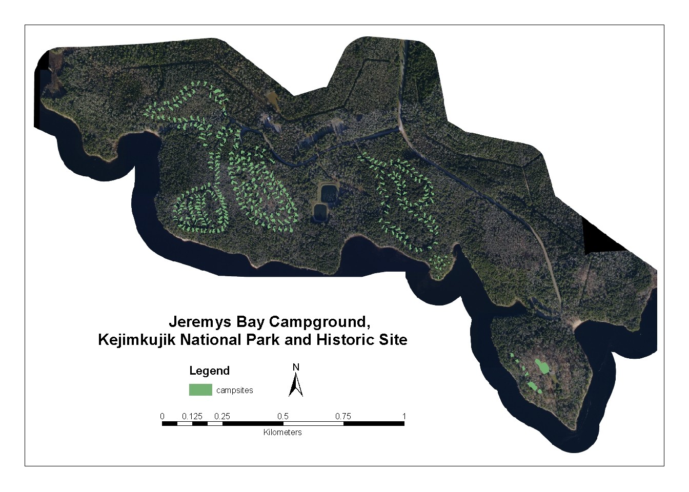
Map of Jeremys Bay Campground

Screen shot of a poster created of the Jim Charles Loop of Jeremys Bay Campground Kejimkujik National Park and Historic Site in Nova Scotia. It was created with ArcMap 9 from data we collected with a Leica RTK & Total Station.

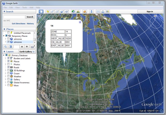
UTM Zones in Google Earth

UTM zones in Google Earth

Here is a neat little Google Earth file that has often been helpful on many of my field trips when I needed to know what UTM zone I was working in. Just open the file in Google Earth, then point and click your location to get info on that time zone. Before I found this neat little resource I was using a large JPG image that showed the zones witch I have available here.

I originaly found this file on Google but have not been able to find the original download source (have found other versions) so you here you can download my working copy here .


Every now and then I come across some little utilities that help to make things easier while working in the field and these pages are mainly my way of sharing them with others while creating a go-to place where I can easily find them when I need them. If you know of any other mapping related utilities like this then let me know and I may include it here on my site with the others.

LIDAR GPS Validation

Summary poster created to show GPS validation data collected for 2003 LIDAR survey of the Annapolis Valley. Poster was one of several presented at the Geomatics Atlantic 2003 Conference held at Acadia University in Wolfville, Nova Scotia and posted at the Applied Geomatics Research Group seminar room in Middleton, Nova Scotia.

 AGRG Annapolis Valley LIDAR Ground Validation Campaign poster

Kejimkujik National Park and Historic Site ortho photos

Below is a poster created showing a seamless ortho photo mosaic of Jeremys Bay Campground, Kejimkujik National Park and Historic Site created from several 25 cm resolution aerial photos flown while studying at COGS in 2003. The image has the location of campsites layered on top and was created for a Spatial GIS Vegetation Database and GIS Spatial Modeling project that I worked on during the summer of 2004.

25 cm aerial photos of Jeremys Bay Campground, Kejimkujik National Park and Historic Site