Geomatics Acronyms and Abbreviations

Using acronyms and abbreviations is commonly practiced in the Geomatics industry and most of the time people just assume that everybody else knows what every acronyms and abbreviation stands for. Well that is obviously not the case most of the time and over the years I have created myself a little digital cheat-sheet of geomatics acronyms and abbreviations that I use with my work in my writing.

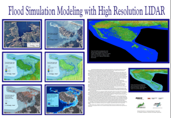
3D Modeling with High Resolution LiDAR

I created and presented this poster featuring LIDAR Color Shaded Relief model of Bouctouche / Shediac area of New Brunswick at the 2004 Geotech event that was held in Toronto.

Bouctouche New Brunswick LIDAR

I created and presented the following poster displaying LIDAR CSR surface modeling of Bouctouche, New Brunswick as part of my Applied Geomatics graduate work at COGS in 2004.

Where will your Geomatics Career Bring You?

My career and has allowed me to be involved in many projects that go well beyond what my education prepared me for …

3D Flood Modeling with LIDAR

The main goal of this project was to generate flood maps and DEMs with better than 30 cm vertical accuracy for the coastal area of southeastern New Brunswick.

LIDAR Data Images – The Beer Store Truck

Cool screen shot image created with LIDAR point data (intensity values) captured during a LIDAR survey in Ottawa with the TITAN mobile laser scanning system.

House of Cards Music Video

Always cool to see Geomatics technology used for non traditional geomatics uses!

Here Radiohead’s new music video was not created with any traditional video cameras but instead they used 3D LIDAR scanning technology.

Actual Radiohead Music Video:

Making the Music Video:

Flood Simulation Modeling with High Resolution LIDAR

I created and presented the following poster that summarized my Flood Simulation Modeling with High Resolution LIDAR project as part of my Applied Geomatics graduate work at COGS in 2004. The areas in the poster are of Shediac & Parlee Beach, New Brunswick

Flood Simulation Modeling with High Resolution LIDAR