3D Modeling with High Resolution LiDAR
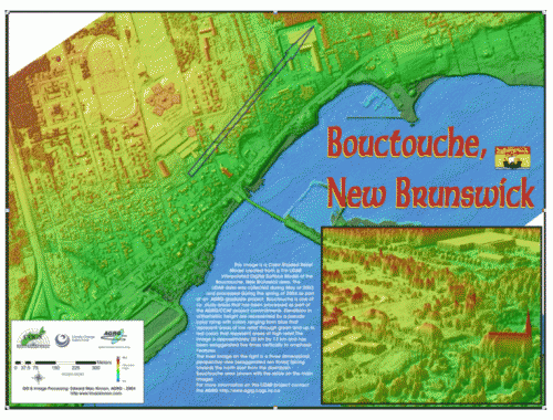
I created and presented this poster featuring LIDAR Color Shaded Relief model of Bouctouche / Shediac area of New Brunswick at the 2004 Geotech event that was held in Toronto.
I created and presented this poster featuring LIDAR Color Shaded Relief model of Bouctouche / Shediac area of New Brunswick at the 2004 Geotech event that was held in Toronto.
The main goal of this project was to generate flood maps and DEMs with better than 30 cm vertical accuracy for the coastal area of southeastern New Brunswick.
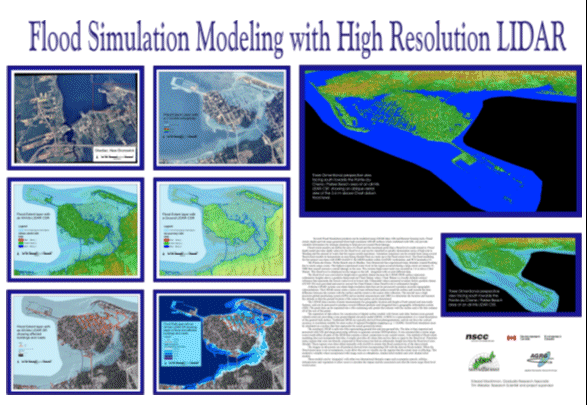
I created and presented the following poster that summarized my Flood Simulation Modeling with High Resolution LIDAR project as part of my Applied Geomatics graduate work at COGS in 2004. The areas in the poster are of Shediac & Parlee Beach, New Brunswick
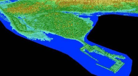

The above two images were created for my LIDAR flood modeling graduate research project. The first image is before the flood scenario; featuring a color shaded relief perspective view pointing south east from the Northumberland Strait landwards across the Pointe Du Chene wharf. The second image is of the same color shaded relief perspective view but features a 2.55 m flood level super imposed on top of it.
The 2.55 m flood level was an actual recorded storm surge water level that effected this area during a winter storm on January 2001. The two images below show the same flood level and area but from an overhead aerial view. The first image is with an orthophoto and the second image is with the color shaded relief.
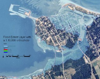
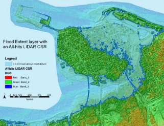

The two images above are of a portion of the small town of Shediac, New Brunswick. Each one is of the same spatial extent, however the one on the left is of an aerial photo of the town (1999) while the one on the right is a color shaded relief model created from high resolution LIDAR data (2003) using PCI Geomatica software. The LIDAR digital surface model (DSM) was part of a LIDAR flood modeling graduate research project.
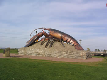
Shediac is a small town located in eastern New Brunswick approximately 20 kilometers north of Moncton. The town calls itself the “Lobster Capital of the World”, hosts an annual lobster festival every July, and the world’s largest lobster sculpture is situated at the main entrance to town.
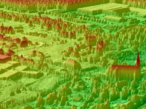
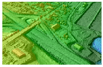
The two images above represent artificial 3D perspective views from different points of origin featuring color shaded relief models that were created from high resolution LIDAR digital surface models as part of a LIDAR flood modeling graduate research project. The image on the left highlights a highway overpass while the image on the right features a residential area with a large school and a church easily detectable in the LIDAR all hits data set. Bouctouche is a small town located in eastern New Brunswick approximately 40 kilometers north of Moncton where the Bouctouche River meets the Northumberland Strait. It was an important aspect of the research study due to the extreme storm surge flooding that the region experiences every winter.
The following co-authored paper featuring my graduate LiDAR research work at the AGRG was published in the Canadian Journal of Remote Sensing in 2006. Airborne light detection and ranging (LiDAR) has the spatial density and vertical precision required to map coastal areas at risk of flooding from water levels typically 1–2 m higher than predicted tides during storm surges. In this study …
