Tag Archive for: CSR

Color Shaded Relief Model – Irvine, California
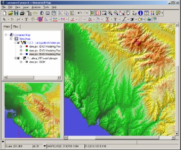
3D CSR Irvine California

The screen grab above was captured during the process of creating a color shaded relief model of Irvine, California. It was created in one of many demos I gave to clients while working for PCI Geomatics and was also used in the following tutorial that I created for the PCI geomatics website.

PCI Geomatics is a world leading developer of image centric geomatics software solutions. The PCI Geomatics flagship software, Geomatica, meets the growing demands of the remote sensing, GIS, cartography, and photogrammetry worlds. PCI Geomatics has long been recognized for offering high-value geomatics software solutions, advanced algorithms, excellent customer assistance, and product support for the widest range of spatial data formats in the industry.
Color Shaded Relief Model – Shediac, New Brunswick

Orthophoto & LIDAR CSR for New Brunswick

The two images above are of a portion of the small town of Shediac, New Brunswick. Each one is of the same spatial extent, however the one on the left is of an aerial photo of the town (1999) while the one on the right is a color shaded relief model created from high resolution LIDAR data (2003) using PCI Geomatica software. The LIDAR digital surface model (DSM) was part of a LIDAR flood modeling graduate research project.

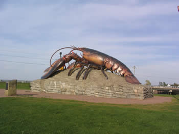
Shediac is a small town located in eastern New Brunswick approximately 20 kilometers north of Moncton. The town calls itself the “Lobster Capital of the World”, hosts an annual lobster festival every July, and the world’s largest lobster sculpture is situated at the main entrance to town.

Cement Lobster in Shediac NewBrunswick Lobster Capital of the World

LIDAR 3D Surface of Bouctouche, New Brunswick

3D color shaded relief (CSR) digital terrain model (DTM) of Bouctouche, New Brunswick created with LIDAR point data.
LIDAR 3D Surface of Bouctouche, New Brunswick

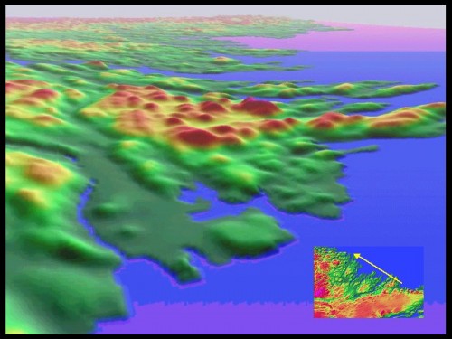
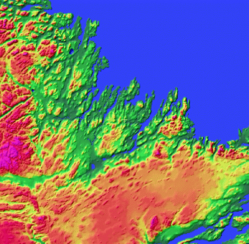
Color Shaded Relief Models – Makkovik, Labrador

Color Shaded Relief Models of Makkovik, Labrador Color Shaded Relief Models of Makkovik, Labrador

The above images are color shaded relief models that I created with a DEM of Makkovik, Labrador. These were part of a data integration project that I was involved with during my intense Remote Sensing training at the Center of Geographic Sciences (COGS) in Nova Scotia. the Makkovik region is a coastal area along the eastern coast of northern Canada that is rich with geologic outcrops.

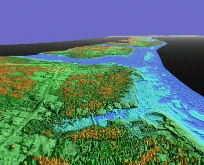
Color Shaded Relief Models – Cap Pele, New Brunswick

Color Shaded Relief Models of Cap Pele, New Brunswick Color Shaded Relief Models of Cap Pele, New Brunswick

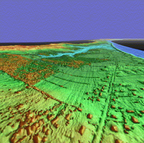
The two images above represent artificial three dimensional perspective views perspective views from different points of origin featuring color shaded relief models that were created from high resolution LIDAR digital surface models as part of a LIDAR flood modeling graduate research project.

The study area for the project consisted of the coastal Gulf Shore region of southeastern New Brunswick from Kouchibouguac National Park south to Jourimain Island (location of the Confederation Bridge). The coastal zone of New Brunswick is a picturesque fishing region that boasts several kilometers of sandy beaches with some of the warmest salt water temperatures north of Virginia.

Color Shaded Relief Model of Antigonish Highlands

The large image on the featured as part of this research poster is a color shaded relief model of the Antigonish Highlands in Nova Scotia. The Antigonish Highlands are underlain by a block of older crustal rocks which are bounded and transected by numerous major faults. The Unit stands at an average elevation of …

Terrain Analysis of the Antigonish Highlands

Integration of Digital elevation Models (DEMs) and Imagery to provide Terrain Analysis of the Antigonish Highlands using DEMs generated from RADARSAT Satellite data