Digital Terrain Modeling – Shaded Relief Models
A shaded relief model uses different color shades according to the varying levels of elevation and azimuth to create an enhanced simulated terrain. The shading is done with the assumption of a defined light source at a fixed location, shone across the surface. The user-specified light source will then determine the positions of shadows and highlighted slopes making ones facing light source appear bright and those facing away appear dark. By default shaded relief models are created with a grey scale ramp that represent the surface reflectance from the light source at any altitude and any azimuth however adding color to it can add an extra chromo stereoscopic component to it.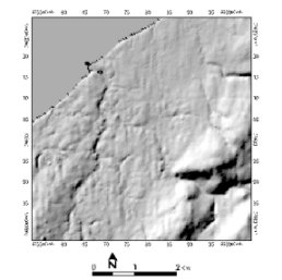
Assuming that a straight line is drawn connecting the user defined point source to the top left pixel of the image, the azimuth angle is the aspect of this line in degrees clockwise from north; the elevation angle is the elevation of the line in degrees from the horizontal.
The shaded grey level for each cell is the result of a calculation from the cosine of the angle between the normal vector to the surface (i.e. slope andaspect) and the direction of illumination. All surfaces not illuminated by the light source such as a slope of 90 degrees will be set to 0. An elevation exaggeration is sometimes added to help enhance the features of a fairly homogeneous surface.
In the example shown to the right, a raster aspect map of Lismore, Nova Scotia was derived from a digital elevation model (DEM) calculated with an azimuth angle of 315 degrees and an elevation angle of 45 degrees.
Shaded Relief related:
- Creating a Color Shaded Relief Model from a DEM with PCI Geomatica v9.1 software
- 3D Modeling with High Resolution LIDAR – presented at the GeoTec Conference in Toronto,Ontario and displayed at the Applied Geomatics Research Group in Middleton, Nova Scotia
- Bouctouche, NewBrunswick – Color Shaded Relief Poster presented at the CCAF annual general meeting held at the University of Moncton in Moncton, New Brunswick, and displayed at the Applied Geomatics Research Group in Middleton, Nova Scotia
- Flood Risk Mapping using LIDAR, SE NB Climate Change Action Fund presented at Geomatics Atlantic 2004 Conference held at the University of New Brunswick in Fredricton, New Brunswick
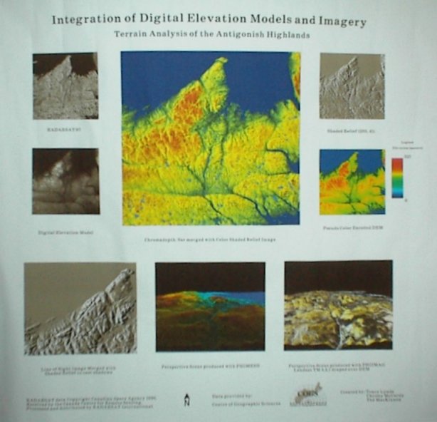
- Integration of Digital elevation Models and Imagery : Terrain Analysis of the Antigonish Highlands – presented at the Center of Geographic Sciences in Lawrencetown, Nova Scotia
- Makkovik,Labrador – 3D modeling and Data Integration presented at the Bedford Institue of Oceanography in Dartmouth, Nova Scotia
- Surface Modeling and LIDAR Validation
- Three Dimensional Flood Modeling with High Resolution LIDAR – (Graduate Project Final Paper) Middleton, Nova Scotia: Applied Geomatics Research Group, Centre of Geographic Sciences, 200 pages
- Three Dimensional Flood Modeling with High Resolution LIDAR presentation from the Canadian Institute of Geomatics 2005 Conference held in Ottawa,Ontario
- More…

