Tag Archive for: CSR

Advocate Harbour Color Shaded Relief Map

A new large 8 foot color shaded relief map that I have created has been posted for display at a local tourist kiosk in Advocate Harbour, Nova Scotia. Now both tourists and residents of the area will be able to gain a better appreciation of the topography that borders the Northern Bay of Fundy region

Bouctouche New Brunswick LIDAR

I created and presented the following poster displaying LIDAR CSR surface modeling of Bouctouche, New Brunswick as part of my Applied Geomatics graduate work at COGS in 2004.

Color Shaded Relief Models

A color shaded relief (CSR) utilizes chromo stereoscopic techniques to help emphasize the depth of the Z dimension from traditional shaded relief models that already portray the presence of an elevation difference. Using carefully edited …

Digital Terrain Modeling – Color Shaded Relief Models

A color shaded relief (CSR) model utilizes chromo stereoscopic techniques to help emphasize the depth of the Z dimension from traditional shaded relief models that already portray the presence of an elevation difference.

Digital Terrain Modeling

Digital Terrain Modeling is the process of simulating or representing the relief and patterns of a surface with numerical and digital methods. It has always been an integral component to geology related fields such as geomorphology, hydrology, tectonics and oceanography but over the past decade has also become a major component to non geophysical applications such as GIS modeling, surveying and land use planning.

Terrain Models are derived from data represented by digital elevation models (DEMs) and can include shaded relief models, slope and aspect models, perspective scene generation, and drainage basin analysis (and other models).

Color Shaded Relief Model – Gatineau, Quebec

This is one of several color shaded relief (CSR) models I created of Gatineau foot hills of Quebec. The city of Ottawa is featured in the national capital region near the bottom center of the image across the river just …

Color Shaded Relief Model of Vancouver Island

Color shaded relief (CSR) model created using a DEM of Vancouver Island, British Columbia using PCI Geomatica software. The …

Color Shaded Relief Models – Pointe Du Chene, New Brunswick

Color Shaded Relief Models of Pointe Du Chene, New BrunswickColor Shaded Relief Models of Pointe Du Chene, New Brunswick with flood
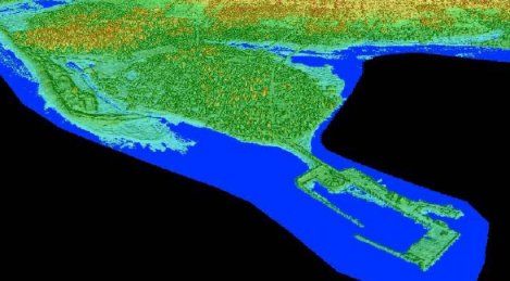
The above two images were created for my LIDAR flood modeling graduate research project. The first image is before the flood scenario; featuring a color shaded relief perspective view pointing south east from the Northumberland Strait landwards across the Pointe Du Chene wharf. The second image is of the same color shaded relief perspective view but features a 2.55 m flood level super imposed on top of it.

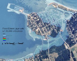
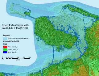
The 2.55 m flood level was an actual recorded storm surge water level that effected this area during a winter storm on January 2001. The two images below show the same flood level and area but from an overhead aerial view. The first image is with an orthophoto and the second image is with the color shaded relief.

Pointe Du Chene, New Brunswick with floodPointe Du Chene, New Brunswick with flood